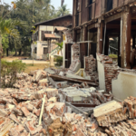
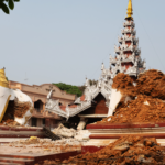
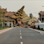
The devastating M7.7 earthquake that struck central Myanmar, claiming over a thousand lives and causing widespread destruction, highlights the complex interplay of seismic forces and disaster preparedness challenges in one of Asia's most active fault zones.
The Geology Behind the Destruction
Myanmar's location along the Himalayan-Burmese Arc—where the Indian Plate collides with the Eurasian Plate at 5 cm per year—created intense pressure along the Sagaing Fault. The earthquake's shallow 10 km depth amplified ground shaking, collapsing inadequately engineered structures and triggering landslides that hindered rescue efforts.
Cross-Border Impact
Tremors reverberated 300 km northeast to China's Yunnan Province, injuring two residents in Ruili City. The quake released energy equivalent to 300 atomic bombs, underscoring the region's vulnerability to tectonic activity.
Urban Risks in Seismic Zones
Proximity to Mandalay, Myanmar's second-largest city, exacerbated casualties. Experts note that many buildings lacked earthquake-resistant designs, echoing risks seen in other developing nations along active faults.
Preparing for the Next Big One
Key survival tips include: dropping under sturdy furniture during shaking, storing 3-day emergency supplies, identifying landslide-safe zones in rural areas, and practicing community drills. Post-quake measures like shutting off gas valves and keeping protective footwear accessible could prevent secondary disasters.
Historical parallels to Myanmar's 1930 Bago earthquake (M7.3) suggest that combining structural reinforcement with public education can significantly reduce future casualties in seismic hotspots.
Reference(s):
cgtn.com


