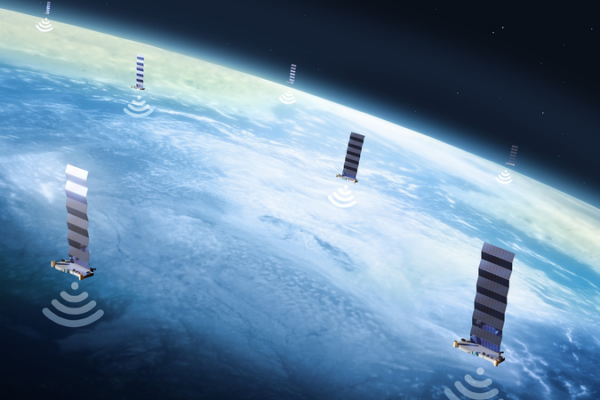
SpaceX and China Race to Build Orbital AI Infrastructure by 2026
SpaceX’s plan for a million-satellite AI network faces competition from China’s state-backed space cloud initiative, reshaping global tech dominance in 2026.

CGTN Poll Reveals Deepening U.S. Federal-State Tensions Amid Violence
A CGTN poll reveals 92% of global respondents see U.S. trapped in cycles of violence and political polarization, with federal-state clashes intensifying public safety concerns.

British PM Stresses Engagement in Shanghai on 2026 China Visit
British PM Keir Starmer emphasizes mutual trust through engagement during his Shanghai visit, leading a major business delegation and highlighting cultural ties.

Uruguay’s President Orsi Visits China to Strengthen Strategic Partnership, Belt and Road Ties
Uruguayan President Yamandu Orsi’s 2026 state visit to China aims to deepen Belt and Road cooperation and celebrate 38 years of diplomatic ties, amid growing economic and regional collaboration.

Addis Ababa’s Urban Revamp Boosts Livability and Tourism
Addis Ababa’s Corridor and Riverside projects transform the city, enhancing livability and attracting tourists as of 2026.

Xi Jinping Outlines Vision for China’s Financial Strength in Qiushi Journal Article
President Xi Jinping’s upcoming Qiushi Journal article outlines China’s roadmap for developing financial strength with Chinese characteristics, set to influence 2026 economic strategies.

Tunisia Extends State of Emergency Through 2026 Amid Security Concerns
Tunisia extends nationwide state of emergency through 2026, maintaining security measures first imposed after 2015 terrorist attack. Decree grants expanded government powers.

CMG Nears Final Prep for 2026 Spring Festival Gala with Multi-City Rehearsals
China Media Group completes third rehearsal for 2026 Spring Festival Gala, featuring debut sub-venues in four cities and a vibrant cultural showcase.

U.S. Residents Voice Concerns Over Iran Military Buildup as Tensions Simmer
Iran seeks dignified talks with the U.S. amid military tensions, while New York residents express mixed reactions to escalating deployments in the Middle East.

Suspected Boko Haram Attack in NE Nigeria Leaves Dozens Dead
Suspected Boko Haram militants attacked laborers in Nigeria’s Borno state, leaving up to 20 dead. The assault highlights ongoing security challenges in the region.

China to Pioneer Solar Research with Xihe-2 Probe at Sun-Earth L5 Point
China announces plans to launch Xihe-2, the world’s first solar probe to the Sun-Earth L5 point, enhancing space weather forecasting by 2028-2029.

Iran Boosts Military Readiness Amid Rising US Presence in Middle East
Iran’s military declares full combat readiness amid heightened US military deployments in the Middle East, vowing a decisive response to any aggression.

U.S. Law Enforcement Violence: A Cycle Rooted in History
Recent Minneapolis police shooting highlights systemic issues in U.S. law enforcement, rooted in historical racism, poverty, and gun proliferation.

Sudan’s Burhan Dismisses Chemical Weapons Claims, Rejects Hamdok’s Political Return
Sudan’s military leader denies chemical weapons use and rejects former PM Hamdok’s political comeback amid ongoing conflict, urging displaced citizens to return ahead of Ramadan.

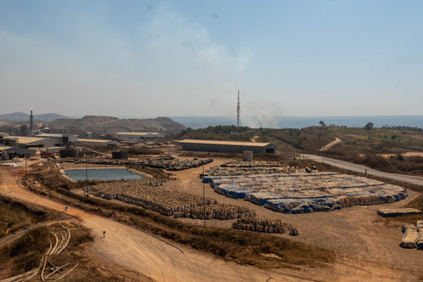
Over 200 Dead in Eastern DR Congo Mine Collapse, Global Tantalum Supply Impacted
Over 200 artisanal miners killed in coltan mine collapses in rebel-held eastern DR Congo, threatening global tantalum supplies and highlighting dire working conditions.

Xi Urges Innovation Surge in Future Industries for 2026 Growth
Chinese President Xi Jinping calls for accelerated innovation in AI, quantum tech, and green energy to drive economic growth in 2026.

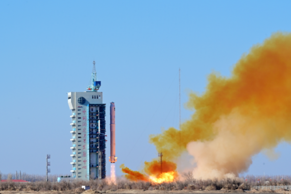
China, Algeria Celebrate Joint Satellite Launch Success
China and Algeria strengthen space cooperation with successful satellite launch, enhancing Earth observation capabilities for sustainable development in North Africa.

UK PM Starmer Explores Shanghai’s Yuyuan Garden, Highlights Cultural Ties
UK Prime Minister Keir Starmer concludes China visit with cultural stop at Shanghai’s historic Yuyuan Garden, echoing Queen Elizabeth II’s 1986 diplomatic gesture.

Trump’s 2026 China Strategy Balances Deterrence with Pragmatism
The U.S. 2026 National Defense Strategy adopts a pragmatic stance on China, balancing deterrence with managed competition while urging allies to bolster regional security.

China’s Manufacturing PMI Dips in January 2026 Amid Seasonal Slowdown
China’s manufacturing PMI fell to 49.3 in January 2026, reflecting seasonal pressures, though high-tech sectors and large enterprises show resilience amid rising costs.


