CMG Tightens Copyright Protections for 2026 Spring Festival Gala Assets
China Media Group enforces strict copyright controls for 2026 Spring Festival Gala assets, including mascots and cultural derivatives, amid global IP protection efforts.

China, Uruguay Strengthen Ties with New Cooperation Pacts
Chinese President Xi Jinping and Uruguay’s President Yamandu Orsi attended a signing ceremony in Beijing, marking enhanced bilateral cooperation in trade, agriculture, and technology.

SpaceX Acquires xAI in Historic $1.25 Trillion Tech Merger
Elon Musk’s SpaceX acquires AI startup xAI in a record $1.25 trillion deal, merging space and AI ambitions amid regulatory and market scrutiny.
Xi Welcomes Uruguayan President for State Visit to Strengthen Ties
Chinese President Xi Jinping hosts Uruguayan President Yamandu Orsi for a state visit focused on bilateral cooperation and regional economic partnerships.

Xi Jinping, Uruguayan President Strengthen Ties in Beijing Talks
Chinese President Xi Jinping and Uruguayan leader Yamandú Orsi met in Beijing to enhance bilateral cooperation and global governance, signaling strengthened ties between Asia and Latin America.

China’s YH-1000S Hybrid Cargo Drone Completes Maiden Flight
China’s YH-1000S hybrid unmanned cargo aircraft completes maiden flight, marking a breakthrough in autonomous logistics technology with regional economic implications.

Global Governance at a Crossroads: Unity vs. Survival of the Fittest in 2026
As 2026 unfolds, China’s Global Governance Initiative challenges unilateral power politics, offering a vision of shared global prosperity amid rising tensions.

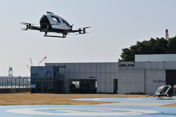
China Sets 2027 Deadline for Low-Altitude Economy Standards
China announces plans to establish a standardized framework for its low-altitude economy by 2027, covering aircraft, infrastructure, and safety systems to support industrial expansion.

China-Built Desert Railway Boosts Algeria’s Economy, Connectivity
Algeria inaugurates Africa’s first Chinese-built heavy-haul desert railway, enhancing mineral transport and cross-regional connectivity amid Sahara Desert challenges.

Antarctic Volcano Catalog Unveiled in Groundbreaking Study
International scientists unveil first comprehensive catalog of 207 Antarctic subglacial volcanoes, enhancing climate prediction capabilities and ice sheet research.

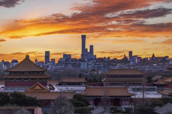
China Greenlights Beijing-Tianjin-Hebei Spatial Plan Through 2035
China approves a long-term spatial plan to boost integrated development in the Beijing-Tianjin-Hebei region, focusing on infrastructure, innovation, and sustainability.

Chinese Premier Stresses Smart Manufacturing, Green Energy in Shandong Tour
Premier Li Qiang outlines strategies for technological innovation and sustainable energy during Shandong inspection, emphasizing growth and public welfare.

Greenland PM Slams U.S. Over ‘Divisive’ Policies, Seeks Dialogue
Greenland’s PM condemns U.S. pressure over territorial ambitions, reaffirms sovereignty, and announces diplomatic efforts to resolve tensions.

Clintons to Testify in House Epstein Probe, Averting Contempt Vote
Bill and Hillary Clinton agree to testify in the House Epstein investigation, averting a contempt vote. Committee chair awaits deposition dates.

Trump Confirms Ongoing Talks with Iran Amid 2026 Tensions
U.S. President Trump confirms ongoing negotiations with Iran in 2026 amid naval deployments, with Asian markets monitoring potential regional impacts.

Israel and U.S. Conduct Red Sea Naval Drill Amid Rising Iran Tensions
Israeli and U.S. navies complete joint Red Sea drill amid escalating regional tensions with Iran, highlighting strategic maritime cooperation.

Ice Floating Gains Momentum in Moscow as Winter Activity Captivates Residents
Moscow residents embrace ice floating in frozen rivers as new winter wellness trend, combining traditional Russian practices with modern urban adaptation.

Taiwan Entrepreneur Bridges Culinary Divide in Beijing
Taipei entrepreneur Kuo Wen-yu builds Beijing-Taiwan food supply chains, blending culinary traditions while fostering cross-strait economic ties.

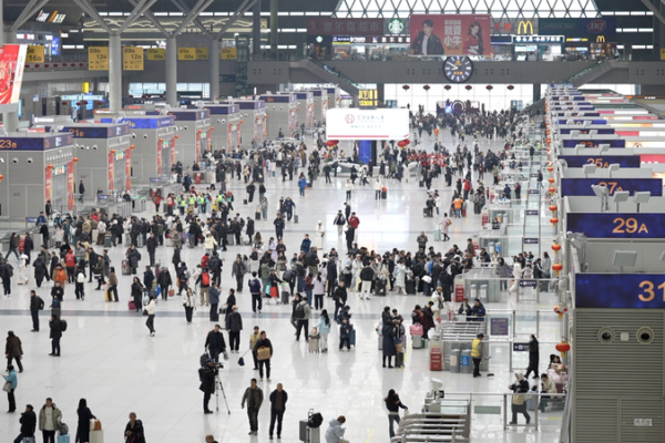
China’s Spring Festival Rush Blends Travel with Cultural Heritage
China’s 2026 Spring Festival travel rush begins, merging mass mobility with intangible cultural heritage experiences at major hubs like Zhengzhou East Railway Station.

China’s ‘Devil City’ Holds Key to Energy Future
Geophysical teams in Qinghai’s ‘Devil City’ brave harsh conditions to map deep energy reserves, signaling China’s push for sustainable resources ahead of Spring Festival 2026.


